
Windshield Survey · Limuru Road · Parklands to Ruaka
Limuru Road Windshield Survey: Apartment & Commercial Blocks from Parklands to Ruaka
A photographed, GPS-tagged drive along Limuru Road recording what is actually being built and occupied: apartment blocks, mixed-use podiums, and commercial frontages.
Method
How this windshield survey was done
A windshield survey records what is visible from the road without entering sites. Each photograph in this survey was taken from a moving vehicle with a phone camera that wrote the latitude, longitude, and capture time into the image metadata. We sorted the frames by that metadata to confirm which road each one belongs to, then analysed a representative set of apartment, mixed-use, and commercial blocks.
Read the results as market evidence, not as measurements:
- Storey counts are visual estimates from floor lines and balconies, shown with a tilde.
- Status (completed or under construction) reflects scaffold netting, exposed frames, and finishes at the time of capture.
- The survey shows nothing about title, ownership, rents, occupancy, soil, or approvals.
- The buildings are third-party properties; they are not Patment Invest projects.
Route
Segments of the survey
The photographs fall into these sections along the road, based on GPS position and capture time.
| Segment | Approx. location | Photographs | GPS span (decimal degrees) | What stood out |
|---|---|---|---|---|
| Ruaka | Limuru Road through Ruaka | 11 | -1.204 to -1.2025 lat; 36.7689 to 36.773 lon | Dense mid- and high-rise apartment infill with active construction frames. |
| Ruaka to Two Rivers section | Between Ruaka and the Two Rivers node | 5 | -1.2153 to -1.2071 lat; 36.7929 to 36.7964 lon | Completed blocks beside netted frames; landscaped modern frontages. |
| Parklands approach | Limuru Road approaching Parklands and town | 4 | -1.2559 to -1.2535 lat; 36.8231 to 36.8256 lon | Older low-rise commercial strips with tall towers behind and netted frames ahead. |
Photographs
What we saw along Limuru Road
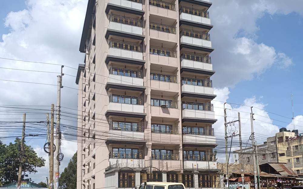
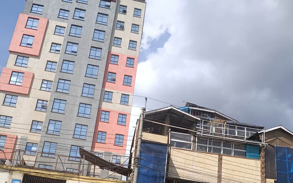
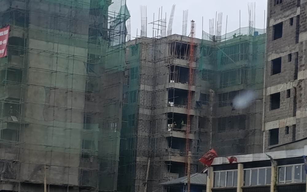
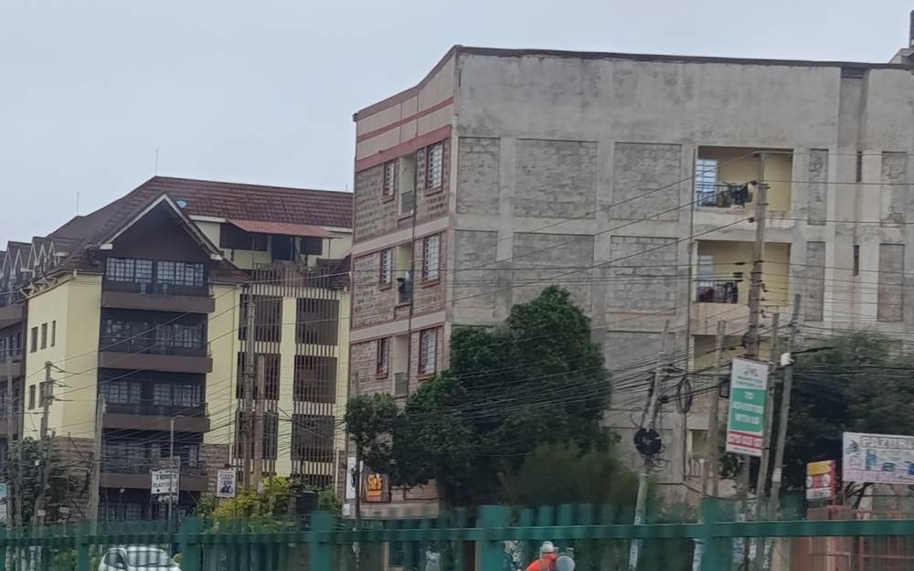
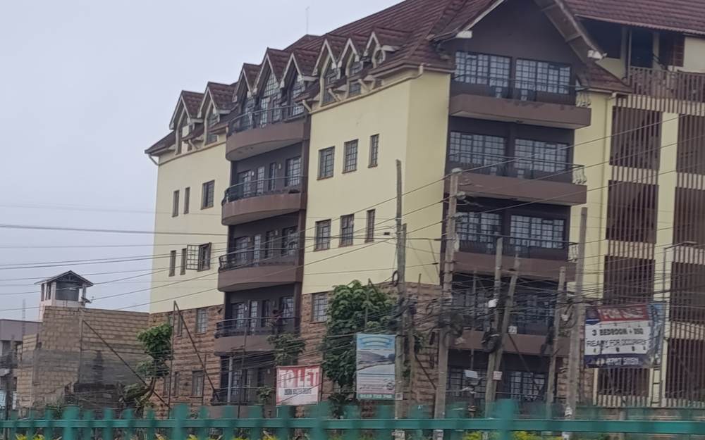
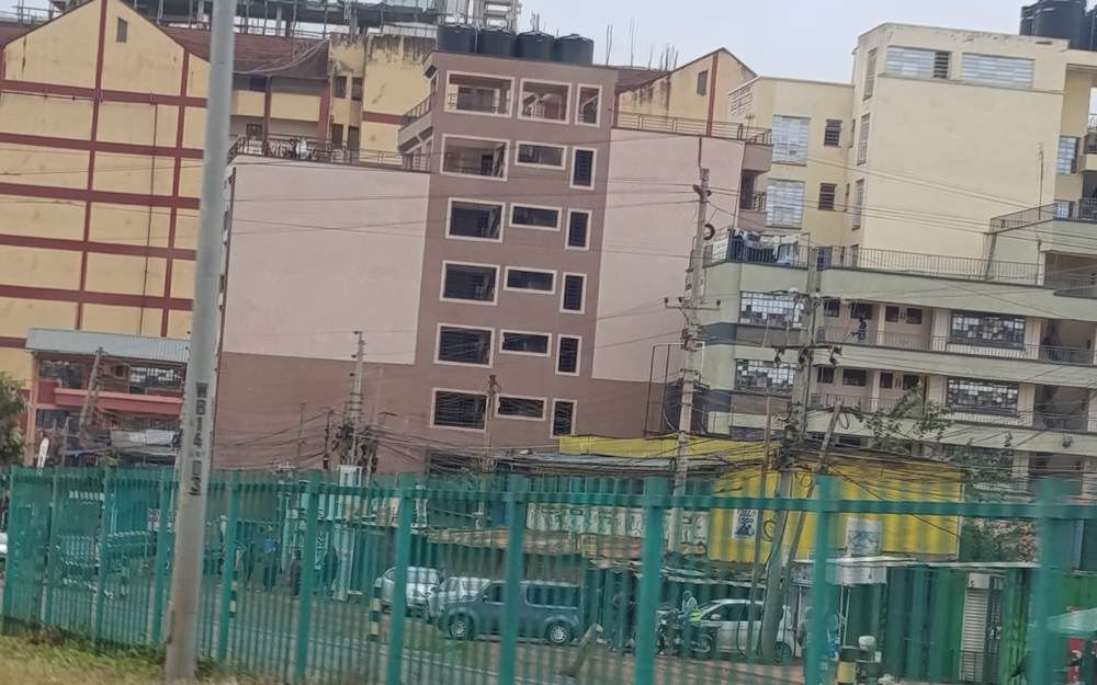
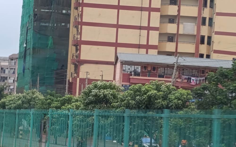
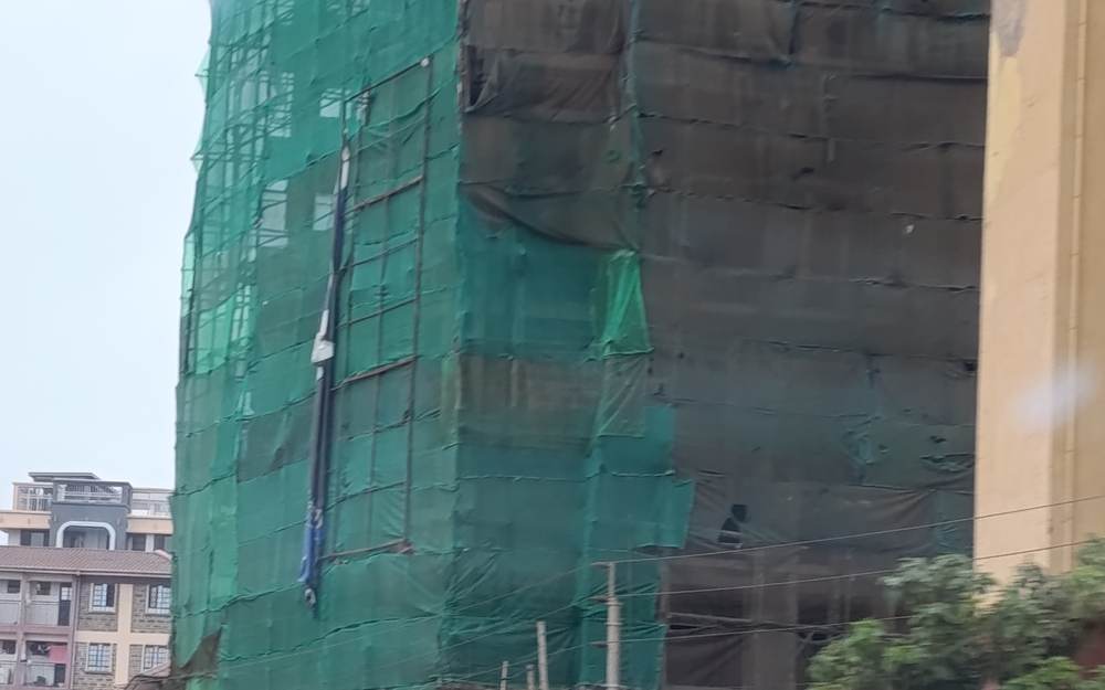
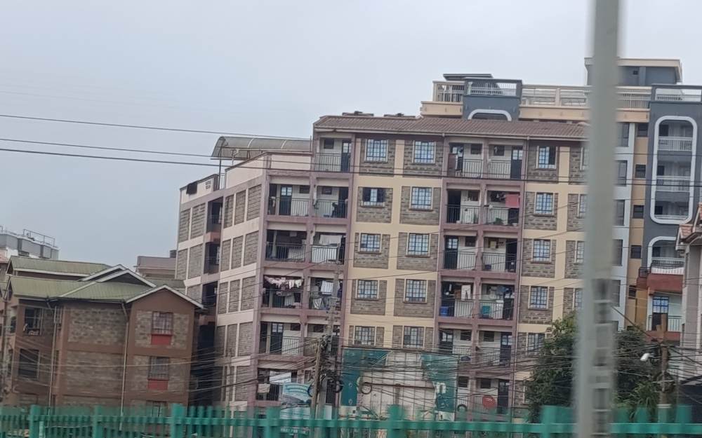
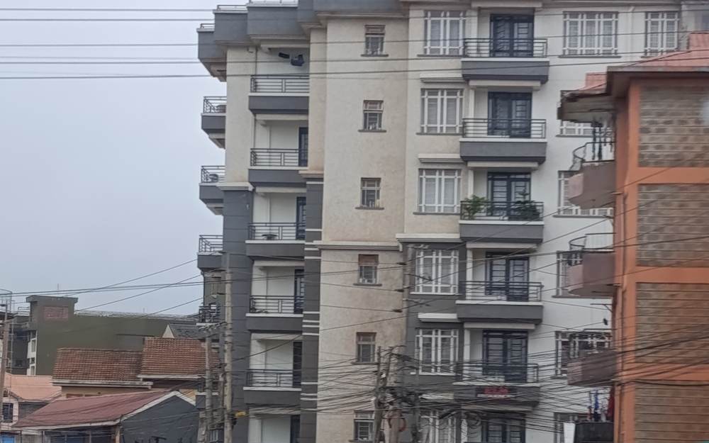
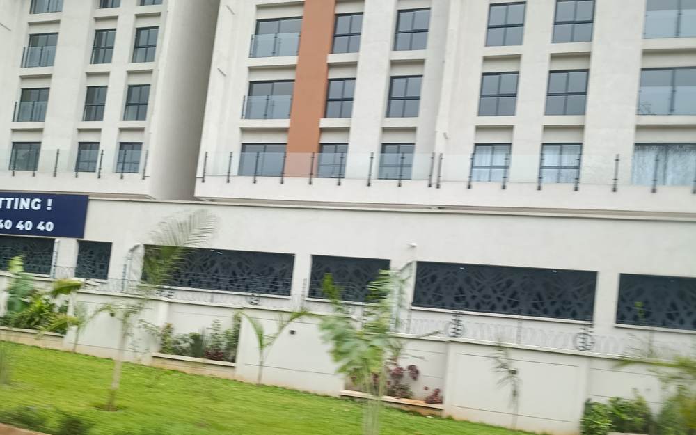
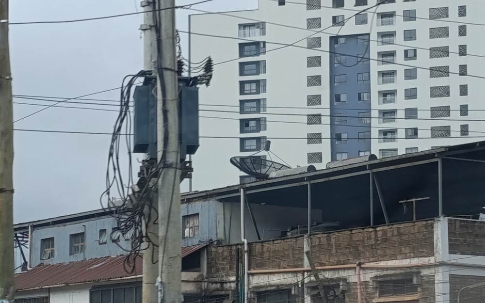
Each caption gives the camera reference, capture time, GPS position, typology, estimated storeys, and construction status.
Observation log
Block-by-block log of the 12 frames analysed
| Reference | Captured | GPS (lat, lon) | Typology | Est. storeys | Status | Ground floor | Notes |
|---|---|---|---|---|---|---|---|
| IMG_20261104_142914 | 04 Nov 2026, 14:29 | -1.20251, 36.76892 | Apartment block | ~9–10 | Completed | Not clearly visible | Balcony on every floor and a plain beige facade; stands beside low roadside kiosks and a dirt verge under kerb works. |
| IMG_20261104_143007 | 04 Nov 2026, 14:30 | -1.20307, 36.77049 | Apartment block (mixed old and new) | ~11–12 | Completed | Informal timber and iron-sheet shops at street level next door | Colour-blocked pink and orange facade panels; busy roadside trade at the foot of the tower. |
| IMG_20261107_080511 | 07 Nov 2026, 08:05 | -1.21087, 36.79289 | Apartment blocks (cluster) | ~8–10 | Under construction | Not visible | Three frames wrapped in scaffold netting side by side, with completed blocks adjoining. |
| IMG_20261107_080537 | 07 Nov 2026, 08:05 | -1.20318, 36.76988 | Apartment block | ~6–7 | Finish status unclear | Not visible | Unpainted grey concrete exterior beside an older four-storey building; mid-rise infill on a corner plot. |
| IMG_20261107_080541 | 07 Nov 2026, 08:05 | -1.20318, 36.76988 | Mixed-use / apartment block | ~6–7 | Completed | Not visible | Cream and brown facade with pitched roof sections; common Ruaka mid-rise form. |
| IMG_20261107_080554 | 07 Nov 2026, 08:05 | -1.20320, 36.76893 | Mixed-use mid-rise row | ~5–7 | Completed | Commercial bays likely at street level (partly hidden by fence) | Pastel mid-rise blocks of differing heights sharing a frontage; rooftop levels added to several. |
| IMG_20261107_080559 | 07 Nov 2026, 08:05 | -1.20320, 36.76893 | Apartment block | ~9–10 | Completed | Not visible | A completed pink and yellow block standing directly beside a netted frame under construction. |
| IMG_20261107_080603 | 07 Nov 2026, 08:06 | -1.20320, 36.76893 | Apartment block | ~12+ | Under construction | Not visible | Tallest frame seen on this road; dark mesh on upper floors indicates structure and cladding in progress. |
| IMG_20261107_080605 | 07 Nov 2026, 08:06 | -1.20320, 36.76893 | Apartment block | ~7 | Completed | Not visible | Brown and pink block with balconies; older single-storey building in front. |
| IMG_20261107_080612 | 07 Nov 2026, 08:06 | -1.20381, 36.77209 | Apartment block | ~8 | Completed | Not visible | Grey facade with projecting balconies and a red-brick stair core. |
| IMG_20261107_081216 | 07 Nov 2026, 08:12 | -1.21529, 36.79642 | Mixed-use / amenity block | ~6–7 | Completed | Glazed ground floor suggests commercial or amenity use | Modern white facade with orange accents and a landscaped frontage; the most polished finish observed. |
| IMG_20261107_082312 | 07 Nov 2026, 08:23 | -1.25588, 36.82559 | Commercial strip with tower behind | ~3 (strip), ~10 (tower) | Completed | Active commercial frontage | Older low-rise commercial buildings in front of a taller white mixed-use tower. |
Findings
What the survey shows
Of the 12 frames analysed, 9 show completed blocks and 2 show blocks under construction (1 with finish status unclear).
- In Ruaka, new frames and completed blocks stand side by side within a few hundred metres, so absorption of upcoming completions needs testing before a new block is committed.
- The dominant form is the 6- to 12-storey apartment block, often with commercial bays at street level, rather than single-use offices.
- Informal retail still fronts the road beside several towers, which points to strong footfall for ground-floor commercial units.
- Finishes range from unpainted concrete to landscaped, glazed frontages, so the quality bar for tenant appeal varies widely along the same road.
- Road-edge works (kerbs, fencing, verges) were visible in most frames, so frontage access and road-reserve setbacks need on-site verification.
Implications
What this means for investors
General observations only. Every plot needs its own feasibility review.
- A 6- to 10-storey apartment block with ground-floor commercial bays matches the form most visible on this road.
- With multiple frames under construction nearby, an absorption and competing-stock survey is essential before land is committed.
- Quality of finish and management ease can differentiate a new block from the many plain mid-rise buildings already let.
Related corridors and surveys
FAQ
Questions about this survey
Is a windshield survey a substitute for a feasibility study?
No. It records what is visible from the road on the survey dates. Ownership, title, rents, occupancy, soil, and approvals must be verified separately, which is what a feasibility review does.
How were the storeys counted?
Storeys are estimated visually from floor lines and balconies, so they are approximate and shown with a tilde. They should not be used as a legal or valuation measure.
Which corridor pages relate to this road?
Limuru Road connects the Ruaka, Gacharage, Banana, Ndenderu, and Limuru corridors. Each has its own page with benchmarks and the return simulator.
Want this analysis for your own plot?
Contact us for a customized feasibility review of a specific site on this road.