
Windshield Survey · Thika Road · Pangani to Kenol
Thika Road Windshield Survey: Apartment & Commercial Blocks from Pangani to Kenol
A photographed, GPS-tagged drive along the Thika Road superhighway from the Nairobi end through Roysambu, Ruiru, Juja, and Thika to Kenol, recording the apartment and commercial ribbon along the way.
Method
How this windshield survey was done
A windshield survey records what is visible from the road without entering sites. Each photograph in this survey was taken from a moving vehicle with a phone camera that wrote the latitude, longitude, and capture time into the image metadata. We sorted the frames by that metadata to confirm which road each one belongs to, then analysed a representative set of apartment, mixed-use, and commercial blocks.
Read the results as market evidence, not as measurements:
- Storey counts are visual estimates from floor lines and balconies, shown with a tilde.
- Status (completed or under construction) reflects scaffold netting, exposed frames, and finishes at the time of capture.
- The survey shows nothing about title, ownership, rents, occupancy, soil, or approvals.
- The buildings are third-party properties; they are not Patment Invest projects.
Route
Segments of the survey
The photographs fall into these sections along the road, based on GPS position and capture time.
| Segment | Approx. location | Photographs | GPS span (decimal degrees) | What stood out |
|---|---|---|---|---|
| Nairobi end | Pangani to Muthaiga | 13 | -1.274 to -1.2631 lat; 36.8254 to 36.8391 lon | Tall netted towers and colour-blocked high-rises beside older low-rise buildings. |
| Roysambu to Kahawa | Roysambu, Githurai, and Kahawa West | 17 | -1.2282 to -1.1893 lat; 36.8799 to 36.9324 lon | Five- to six-storey apartment blocks and unfinished concrete frames with shuttered ground floors. |
| Ruiru | Kimbo and Ruiru | 30 | -1.164 to -1.1068 lat; 36.9556 to 37.0156 lon | The longest stretch: continuous mid-rise apartments over street-level shops. |
| Juja | Juja and the Gatundu Road approach | 10 | -1.1068 to -1.0969 lat; 37.0156 to 37.0271 lon | Ten-storey blocks and long five-storey red-roofed blocks. |
| Thika | Thika outskirts and town | 6 | -1.0692 to -1.0491 lat; 37.0522 to 37.0591 lon | Mid-rise blocks and frames rising behind the carriageway. |
| Kenol | Kenol approach | 5 | -0.9434 to -0.9358 lat; 37.1247 to 37.1361 lon | Five- to six-storey blocks with shuttered ground-floor bays. |
Photographs
What we saw along Thika Road
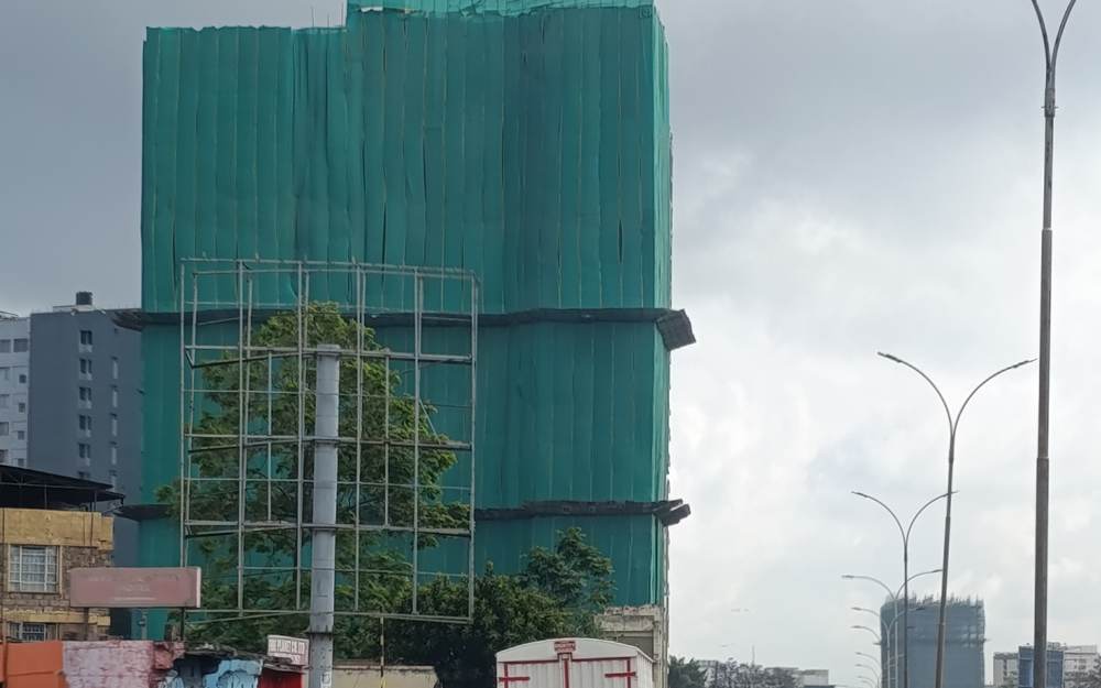
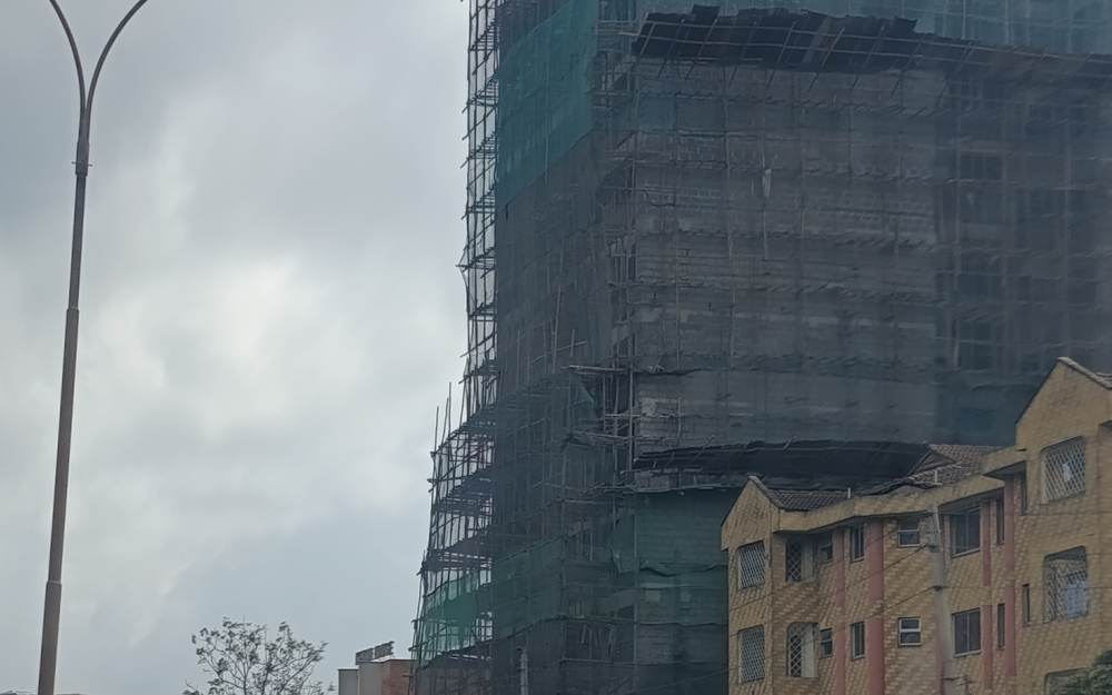
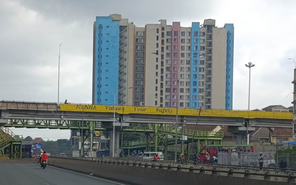
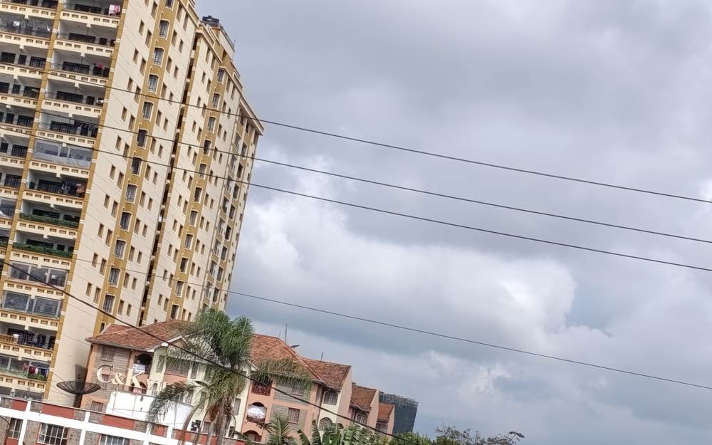
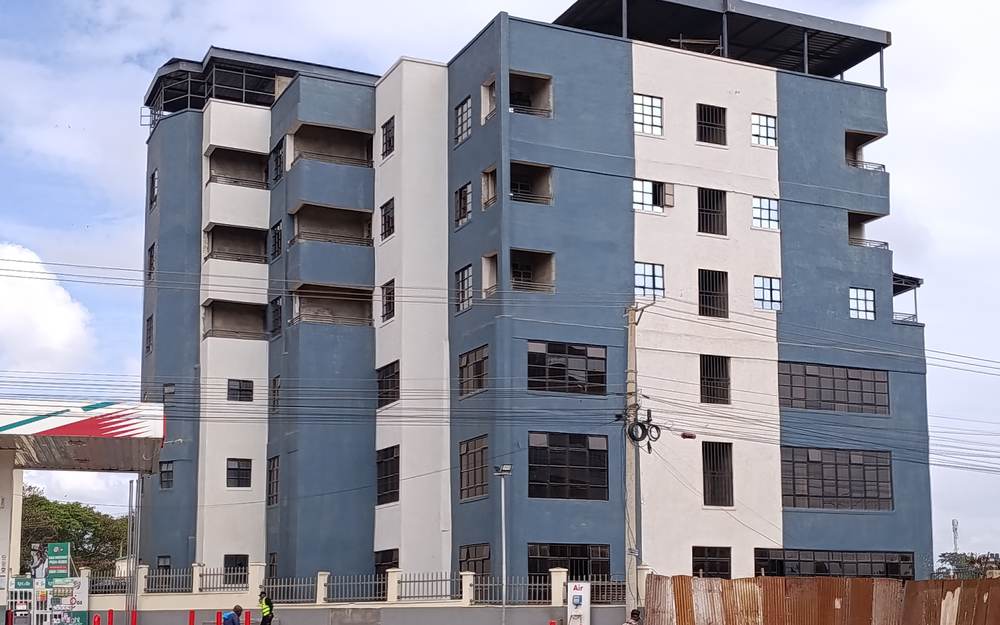
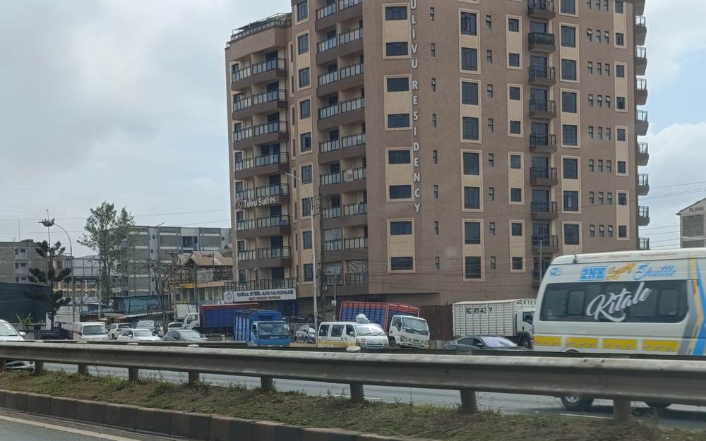
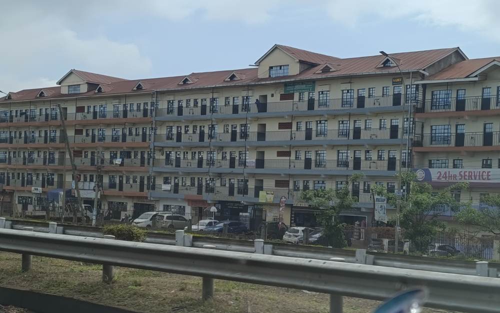
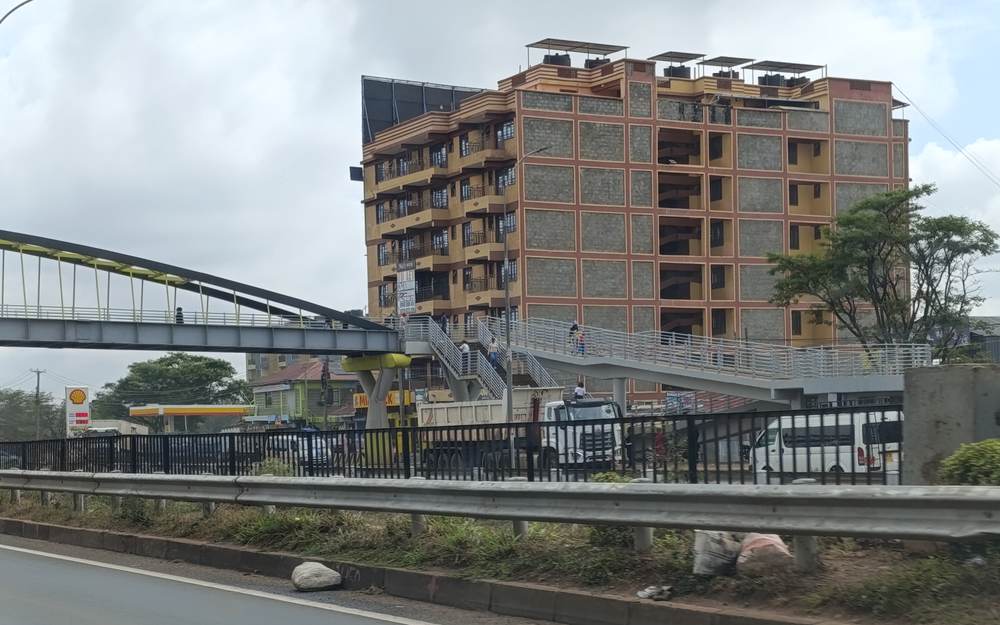
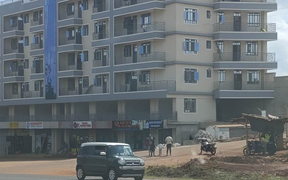
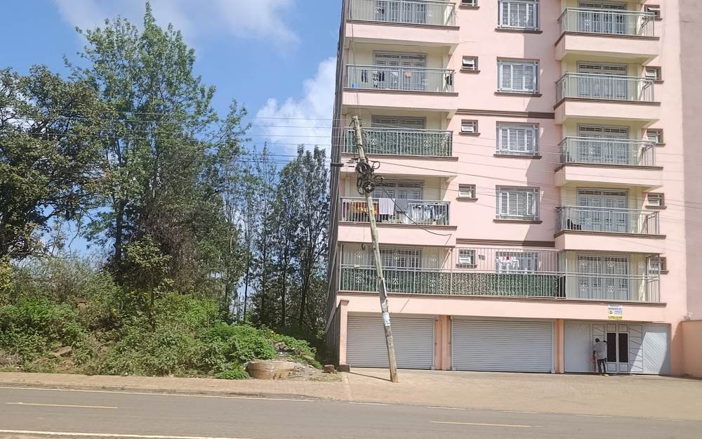
Each caption gives the camera reference, capture time, GPS position, typology, estimated storeys, and construction status.
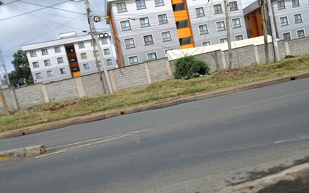
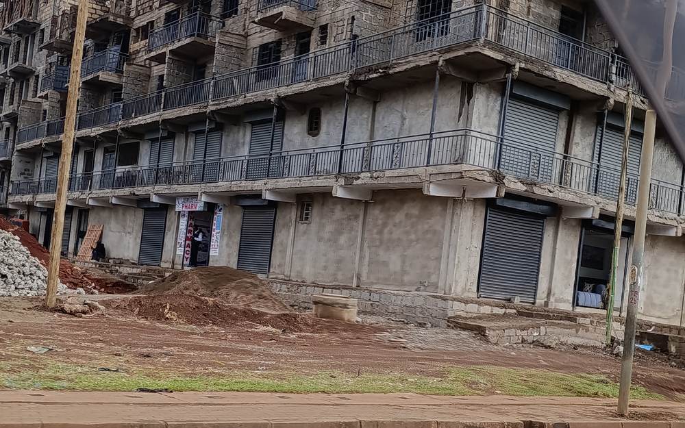
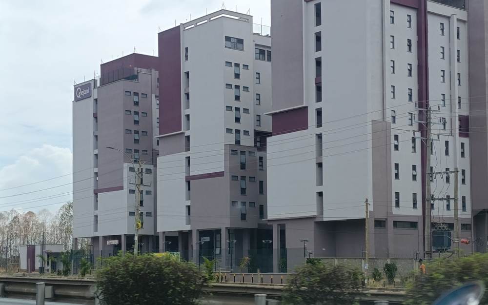
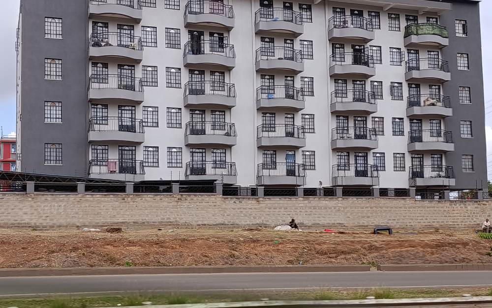
Observation log
Block-by-block log of the 14 frames analysed
| Reference | Captured | GPS (lat, lon) | Typology | Est. storeys | Status | Ground floor | Notes |
|---|---|---|---|---|---|---|---|
| IMG_20261107_093658 | 07 Nov 2026, 09:36 | -1.27398, 36.82541 | Apartment tower | ~15+ | Under construction | Not visible | Large frame in green netting near the Nairobi end, among dense roadside frontage. |
| IMG_20261107_093701 | 07 Nov 2026, 09:37 | -1.27251, 36.82736 | Apartment tower beside older block | ~15+ (tower), ~4 (older block) | Under construction (tower) | Arched shop frontage on the older block | Dark-netted tower rising next to a cream and ochre four-storey building. |
| IMG_20261107_093746 | 07 Nov 2026, 09:37 | -1.26848, 36.83276 | Apartment towers | ~14–16 | Completed | Not visible | Blue and pink colour-blocked towers beyond a yellow pedestrian footbridge over the carriageway. |
| IMG_20261107_094511 | 07 Nov 2026, 09:45 | -1.22821, 36.87987 | Apartment tower | ~14 | Completed | Temporary roadside kiosks at the base | A tan residential tower with informal retail clustered along the road edge. |
| IMG_20261107_094611 | 07 Nov 2026, 09:46 | -1.22021, 36.89077 | Apartment blocks (row) | ~5–6 | Completed | Not visible | White blocks with orange accents set back behind a boundary wall and grass verge. |
| IMG_20261107_095221 | 07 Nov 2026, 09:52 | -1.21227, 36.90589 | Mixed-use frame | ~5 | Under construction | Shuttered ground-floor bays visible | Exposed concrete frame with roller shutters at street level and rubble on the plot. |
| IMG_20261107_095801 | 07 Nov 2026, 09:58 | -1.18931, 36.93244 | Apartment blocks (cluster) | ~8–10 | Completed | Not visible | White, grey, and purple blocks with a landscaped strip along the frontage. |
| IMG_20261107_100209 | 07 Nov 2026, 10:02 | -1.15935, 36.95848 | Apartment block | ~6 | Completed | Not visible | Grey facade with regular balconies standing on an otherwise bare frontage plot. |
| IMG_20261107_100224 | 07 Nov 2026, 10:02 | -1.15609, 36.95998 | Apartment block | ~6 | Completed | Not visible | Blue and white block with a rooftop structure beside a junction and a fuel forecourt. |
| IMG_20261107_101127 | 07 Nov 2026, 10:11 | -1.10684, 37.01562 | Apartment block | ~10 | Completed | Not visible | Tan residential block beside the carriageway with a matatu in the foreground. |
| IMG_20261107_101213 | 07 Nov 2026, 10:12 | -1.10131, 37.02106 | Apartment block (long) | ~5 | Completed | Not visible | Long block with red roofing and a continuous balcony line facing the dual carriageway. |
| IMG_20261107_101251 | 07 Nov 2026, 10:12 | -1.09689, 37.02710 | Apartment block | ~7 | Completed | Not visible | Orange and tan mid-rise beside a pedestrian footbridge. |
| IMG_20261107_103226 | 07 Nov 2026, 10:32 | -0.94341, 37.12469 | Mixed-use block | ~6 | Completed | Shop frontage at ground level | Grey and blue block with commercial bays and roadside materials stacked in front. |
| IMG_20261107_103546 | 07 Nov 2026, 10:35 | -0.93582, 37.13606 | Apartment block | ~5 | Completed | Garage-style shutters at ground level | Pink facade with balconies on every floor. |
Findings
What the survey shows
Of the 14 frames analysed, 11 show completed blocks and 3 show blocks under construction.
- The ribbon between Roysambu and Ruiru is dominated by 5- to 10-storey apartment blocks, mostly completed and set along a divided carriageway.
- Ground-floor shutters or shop bays appear on many blocks, so the mixed-use podium is the standard typology, not the exception.
- High-rise towers cluster at the Nairobi end, while the outer sections are predominantly mid-rise.
- Footbridges, guardrails, and a central median were visible in most frames, so direct vehicle access to plots can be restricted and depends on service roads.
- Unfinished frames with shuttered shop bays in Githurai show speculative construction continuing along the road.
Implications
What this means for investors
General observations only. Every plot needs its own feasibility review.
- The visible demand is for 5- to 8-storey apartment blocks with ground-floor commercial bays, which keeps construction costs lower than high-rise.
- Plots must be assessed for service-road access and median breaks rather than assumed frontage on the superhighway.
- Repetition of near-identical mid-rise blocks means differentiation through finish, parking, and management ease matters for tenant retention.
Related corridors and surveys
FAQ
Questions about this survey
Is Thika Road one of your listed corridors?
Our six core corridor pages cover Ruaka, Gacharage, Banana, Ndenderu, Kikuyu, and Limuru. We assess Thika Road plots on request, using the same feasibility approach.
Where does the survey start and end?
The sequence runs from the Nairobi end of Thika Road through Roysambu, Ruiru, Juja, and Thika, with five further frames near Kenol.
Are these buildings Patment Invest projects?
No. They are third-party buildings photographed from the road as market evidence. We do not claim any of them as our own work.
Want this analysis for your own plot?
Contact us for a customized feasibility review of a specific site on this road.